Wildfire Preparedness, Whidbey-StyleWhen it comes to wildfire, do you think of Whidbey Island? Most would venture east of the mountains, but with growing awareness of the effects that drought-prone summer seasons play in wildfire ignition potential on Whidbey Island, we partnered with Central Whidbey Island Fire and Rescue District, Washington Department of Natural Resources, North Whidbey Fire & Rescue District, South Whidbey Fire & EMS, and additional partners, including Island County's Department of Emergency Management and Washington State Parks to bring Firewise to the island.
Our Firewise staff supports residents and communities with expertise in forest health and stewardship, structure and wildland fire protection, and facilitation and community building.
How Firewise can help you
Contact Collin with questions or Request Assistance below to get started! |
“My sense is that this has shown how many hands can work together, and that taking care of where we live generates connection among neighbors. Firewise embraces action steps for safety and prevention, while fostering an increased appreciation for the beauty of where we live.” King 5 News Visits Whidbey
In April 2021, King 5 news' Glenn Farley visited one of our Whidbey Island Firewise Communities, who represent neighbors working collaboratively and proactively together to reduce their wildfire risk and adapt to the natural fire regimes of Whidbey Island through the Firewise USA program.
|
wildfire risk on Whidbey
Wildfire risk is closer than you might think. Fuels, prevailing winds, and topography are the key factors in determining a home’s ignitability during a wildfire incident. On the west side of Whidbey, communities tucked within forested areas along the dry, bluff zones that receive prevailing west winds in summer are more at risk. Through Firewise, homeowners can take proactive steps to understand the science behind home ignitability, and techniques to create defensible space in their home ignition zones.
Did you know that Central Whidbey, specifically, is more at risk because it receives significantly less precipitation than on north and south Whidbey Island? In the dry summer months of June - September, drier, fine fuels coupled with westerly winds and steep slopes increase the hazard of wildfire risk to rural residents. Those who live in forested communities near the bluff north or south of this rain shadow zone can still benefit to learn about Firewise, even though their risk may be less.
Did you know that Central Whidbey, specifically, is more at risk because it receives significantly less precipitation than on north and south Whidbey Island? In the dry summer months of June - September, drier, fine fuels coupled with westerly winds and steep slopes increase the hazard of wildfire risk to rural residents. Those who live in forested communities near the bluff north or south of this rain shadow zone can still benefit to learn about Firewise, even though their risk may be less.
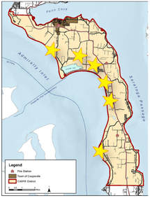
Communities & property in central Whidbey are more at risk
|
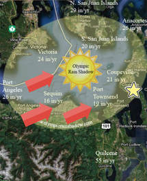
The Olympic Rain Shadow leads to less rain & drier conditions
|
Firewise is designed to educate and empower homeowners about the science behind wildfire, and equip them with the tools to take proactive steps to reduce their risk through home assessments and site visits with tailored recommendations from resource specialists, community presentations from local fire experts, a rich print & digital resource library for both adults and kids, and ongoing support by local professionals at the Whidbey Island Conservation District.
the science behind home ignition
Fuels Are What Matter
When it comes to wildfire risk, it is not a geographical location, but a set of conditions that determine the home’s ignition potential in any community. Wildfire behavior is influenced by three main factors: topography (lie of the land), weather (wind speed, relative humidity and ambient temperature) and fuel (vegetation and man-made structures). In the event of extreme wildfire behavior, extreme weather conditions are normally present, like extended drought, high winds, low humidity and high temperatures, coupled with excess fuel build up including the accumulation of live and dead vegetation material. Additionally, the area’s topography influences the fire’s intensity and rate of spread.
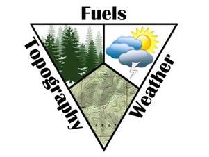
The Wildfire Behavior Triangle
|
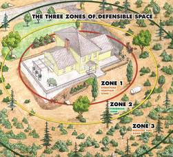
The Home Ignition Zone
|
OF THESE THREE FACTORS, "FUEL" IS THE ONLY ONE WE CAN INFLUENCE.
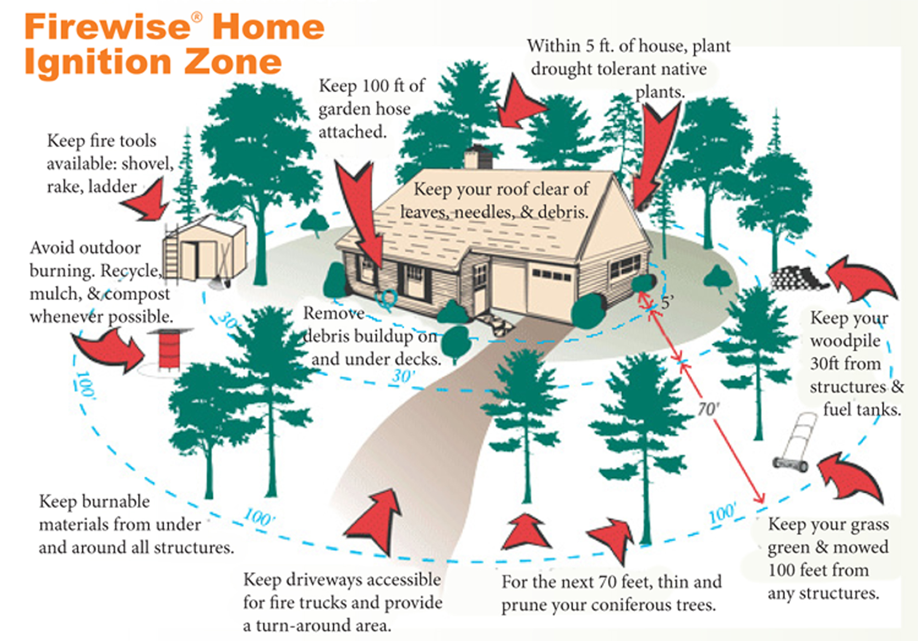
Debris like dead leaves and pine needles left on decks, in gutters and strewn across lawns can ignite from embers. Ladder fuels present a hazard for homes located next to maintained contiguous forest. Fire moving along the ground’s surface can “ladder” into shrubs and low hanging tree limbs to create longer flames and more heat. If your home has flammable features or vulnerable openings, it can also serve as fuel for the fire, and become part of a disastrous chain of ignitions to other surrounding homes and structures.
Debris like dead leaves and pine needles left on decks, in gutters and strewn across lawns can ignite from embers. Ladder fuels present a hazard for homes located next to maintained contiguous forest. Fire moving along the ground’s surface can “ladder” into shrubs and low hanging tree limbs to create longer flames and more heat. If your home has flammable features or vulnerable openings, it can also serve as fuel for the fire, and become part of a disastrous chain of ignitions to other surrounding homes and structures.
|
According to fire science research and case studies, it’s not where a home is located that necessarily determines ignition risk, but the landscape around it, often referred to as the “home ignition zone.” The home ignition zone is defined as the home and its immediate surroundings up to 100 feet. Below is a visual with great tips and tricks to help reduce the threat of wildfire around YOUR home ignition zone. These tips are tailored to Whidbey Island's unique geography and climate. |
Learn about the science behind wildfire from Jack D. Cohen, Research Physical Scientist, United States Forest Service by watching the following video. No one has done more to define the wildland-urban interface problem and empower homeowners to reduce their risk of wildfire than Jack Cohen. His post-fire field examinations and laboratory-based research on fire dynamics led to the concept of the home ignition zone, a phrase he coined.
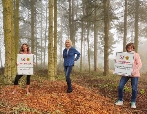
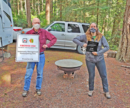
WHIDBEY FIREWISE COMMUNITY HIGHLIGHTS

Residents (from L to R) Lisa Peters, Teri Jo Summer Reiger, and Melanie Beckstrom accept Pondilla Estates' Firewise USA recognition signs.
|
Pondilla EstatesThe Pondilla Estates community in the North Whidbey Fire & Rescue District (NWIFR) in north Coupeville was recognized in August 2020 by the National Fire Protection Association as a Firewise USA site, and Island County's third nationally recognized community! Since March of 2019, the community worked with WICD, CWIFR, and Washington DNR to accomplish the five steps to become a nationally recognized site. This small community of over 30 homes and 60 residents is excited to continue to inspire wildfire preparedness many years into the future.
|
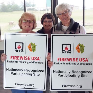
Board Chair of WICH, Ted Case, receives the community's Firewise signs and plaque from Kelsi Mottet, Coordinator of the Firewise Program.
|
Campers HavenWhidbey Island Campers Haven in the Central Whidbey Island Fire & Rescue District (CWIFR) in north Coupeville was recognized in November 2019 by the National Fire Protection Association as an official Firewise USA site, and Island County's second nationally recognized community! Now, their community of over 60 campers are more wildfire prepared and aware than ever, thanks to the efforts led by Joy Page and the Whidbey Island Campers Haven board and members. Check out their local recognition on page 10 of the Whidbey Weekly October 8, 2020 newspaper.
|
Sierra Country Club's Firewise Committe (from left to right) includes Fran Hand, Diane McClaine, and Lynne Scapple.
|
Sierra Country ClubThe Sierra Country Club community in the North Whidbey Fire & Rescue District in north Coupeville are the original pioneers of Whidbey Island's Firewise Program. They achieved their official recognition in May of 2018, after hosting a Community Wildfire Preparedness Day event that brought together over 30 residents who spent over 60 hours of volunteer time removing 1,380 pounds of potentially ignitable fuels from trees and shrubs on community property. Their community remains in good standing through regular outreach to their over 400 residents in 200+ homes on wildfire preparedness tips and resources, and pairing their wildfire preparedness efforts with the community's Emergency Response Committee.
|
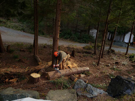
Learn about the Kirkconnell family's journey toward better stewardship of their forest for wildfire resilience through active thinning and pruning.
|
Landowner Spotlight:
The Kirkconnell Family of South Whidbey Check out the story of the Kirkconnell family as they learn about and adapt their 5-acre forested property for promoting its health and wildfire resilience. Click here to read this article, originally published in the May 2020 Whidbey Weekly as part of Washington's Wildfire Awareness Month.
|